roadtrip 2019 |
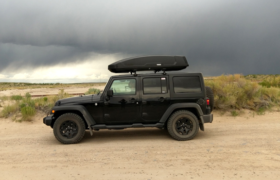 |
| the Jeep always takes you home (link to home page) |
|
waypoints
|
||
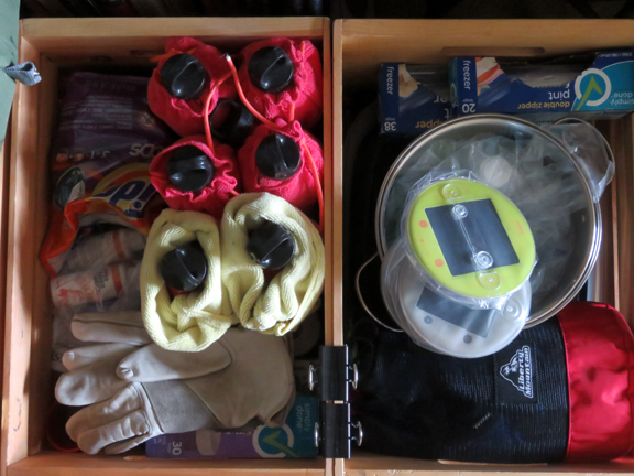
click here or on the image above for more roadtrip kit and kaboodle photos |
day 1: packed and ready
just some stuff about what gets packed for a 7-week roadtrip and how it gets packed.
~~~~~~~~ |
|
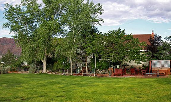
click here or on the image above for more bed & breakfast and campsite photos |
bonus section: campsites and bed & breakfasts
When we're not camping, we like to stay at a bed & breakfast. Some of the bed & breakfasts we've stayed in have been
outstanding and some of the campsites stand out from all the rest. Here are some of the best. This section will be added to
as we go along!
~~~~~~~~ |
|

click here or on the image above for more pecos national historic park photos |
new mexico
The National Park service has this to say about Pecos:
~~~~~~~~ |
|
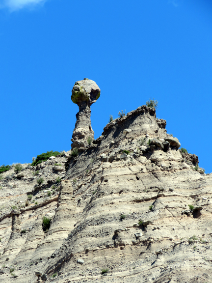
click here or on the image above for more kasha-katuwe tent rocks photos |
new mexico
This site is managed by the U.S. Bureau of Land Management, the neglected branch of our currently dysfunctional Dept. of the Interior.
BLM has this to say:
Precariously perched on many of the tapering hoodoos are boulder caps that protect the softer pumice and tuff below. Some tents have lost their hard, resistant caprocks, and are disintegrating. While fairly uniform in shape, the tent rock formations vary in height from a few feet up to 90 feet." Parking was a challenge - we just happened to luck into a place - and there were too many people on the trail, which follows along in an exquisite slot canyon. Overuse is a real problem that, it turns out, we will find in most of the places we visit. ~~~~~~~~ |
|
|
new mexico
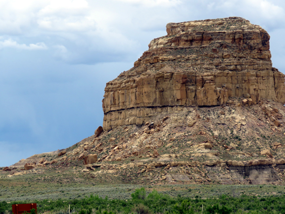
We camped at Chaco Culture National Historic Park two years ago and planned on camping there again, but updates to the campground made that difficult, so we drove in for the day. The road into the park (described HERE) has not improved in the two years since we first drove on it but our jeep was much better suited to it. The part of the road that is packed dirt (about 10 of the 20 miles of gravel/dirt) becomes impassable when it rains much and we managed to get back to the paved road just as a major thunderstorm began to dump buckets of water from the sky. Chaco was the spiritual center of an ancient world. The massive buildings of the ancestral Pueblo peoples are constructed in a distinctive style that shows up everywhere these people migrated, and this site was in use between 850 and 1250 A.D.. ~~~~~~~~ |
|
click here or on the image above for more salmon ruins photos |
new mexico
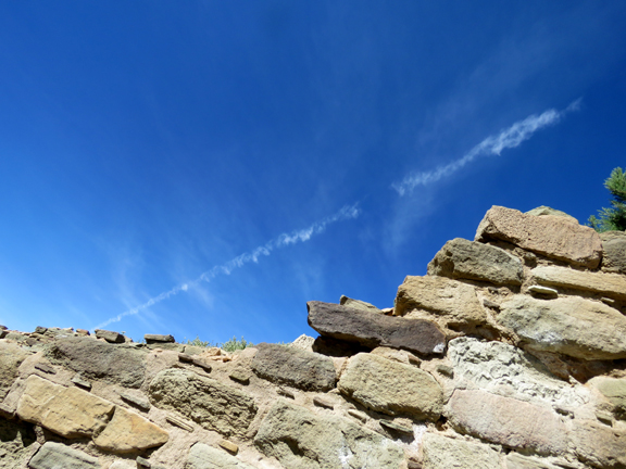
Just off the highway that runs between Bloomfied and Farmington, Salmon Ruins is actually maintained by a non-profit, the San Juan County Archaeological Research Center & Library. It is one of the largest outlying colonies built in the Chacoan style during the 11th century and features the same building style as that found at Chaco. According to Archaeolgy Southwest: "Salmon Pueblo was constructed as a Chacoan outlier - a settlement or enclave of people from Chaco Canyon - around A.D. 1090. At that time, the pueblo had 275 to 325 original rooms spread across three stories, an elevated tower kiva in its central portion, and a great kiva in its plaza. Subsequent use by local Middle San Juan people (beginning in the 1120s) resulted in extensive modifications to the original building: hundreds of rooms were reused, many of the original large rooms were divided into smaller rooms, and more than 20 small kivas were built into pueblo rooms and plaza areas. The site was inhabited by Pueblo people until the 1280s." ~~~~~~~~ |
|
click here or on the image above for more lowry pueblo photos |
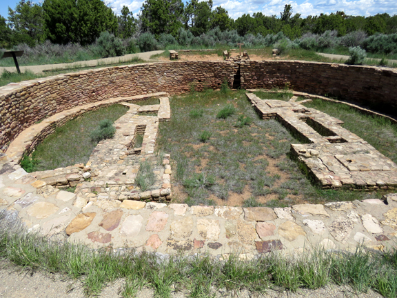
new mexico
From Wikipedia:
~~~~~~~~ |
|
click here or on the image above for more canyonlands photos |
utah
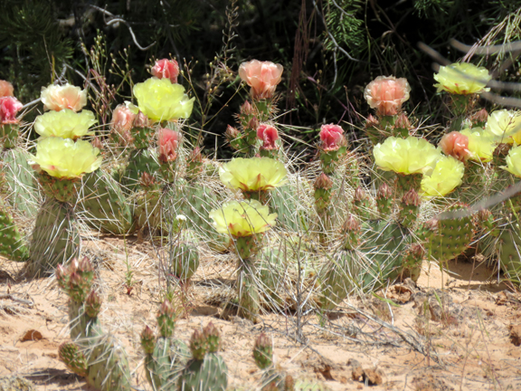
From the National Park Service: "Canyonlands National Park preserves 337,598 acres of colorful canyons, mesas, buttes, fins, arches, and spires in the heart of southeast Utah's high desert. Water and gravity have been the prime architects of this land, sculpting layers of rock into the rugged landscape you see today." We visited on a Saturday along with many other people. ~~~~~~~~ |
|
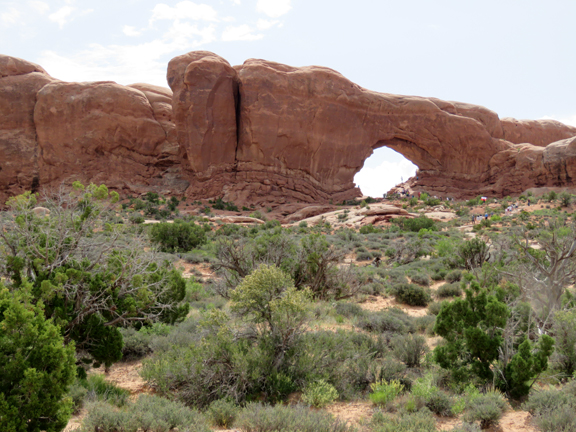
|
utah
From the National Park Service:
That is, if you can get in. And then there's the matter of parking at the trailheads. And the tour busses and noisy tour groups. We visited several of the park's 2,000 arches and there were people everywhere. Most of the arches are, thankfully, accessible only by strenuous hiking trails or the park would be overrun. I don't know what the answer is, but it is not more parking lots. It's great that people visit these national treasures, but we are loving the places into ruin. That said, the above-average rainfall this past year has resulted in cactus blooms that a botanist we met on the trail said occurs only once in ten years, if that. And the arches are amazing... ~~~~~~~~ |
|
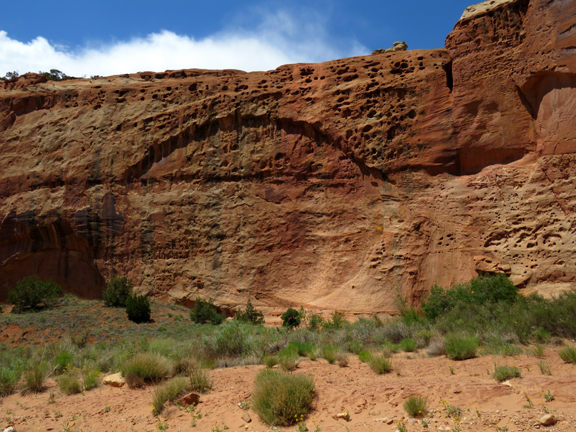
click here or on the image above for more capitol reef photos |
Utah
From the National Park Service:
The most scenic portion of the Waterpocket Fold, found near the Fremont River, is known as Capitol Reef: capitol for the white domes of Navajo Sandstone that resemble capitol building domes, and reef for the rocky cliffs which are a barrier to travel, like a coral reef." ... ~~~~~~~~ |
|
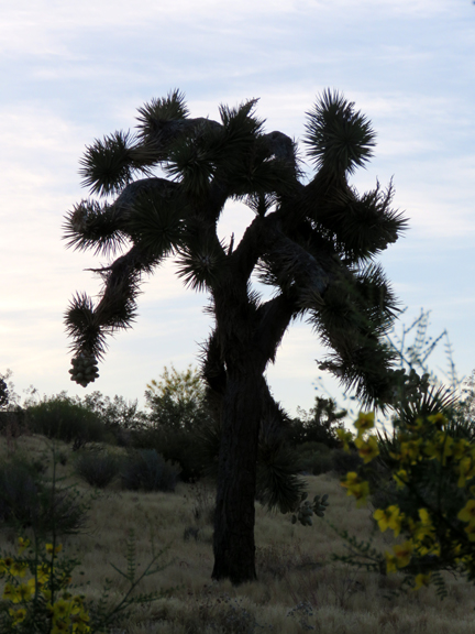
click here or on the image above for more joshua tree national park photos |
California
Joshua Tree National Park was in the news during the most recent Trump Shutdown because of the vandalism done to the park
in the absence of park rangers (joshua trees burned, others decorated with holiday lights, off-road driving in sensitive areas
causing damage to the microbiome soil). At least in the areas we visited, there was no damage visible mostly because
the rangers and volunteers cleaned it up, repaired the damage, and even re-seeded the damaged microbiome soil (experimental).
Joshua trees are actually yucca, not trees, but they look like trees, and though they live a long, long time, their
future is not certain: they propagated and spread because the seed pods passed through the digestive tract of the
now-extinct giant three-toed sloth who carried them into areas not yet inhabited by joshua trees.
~~~~~~~~ |
|
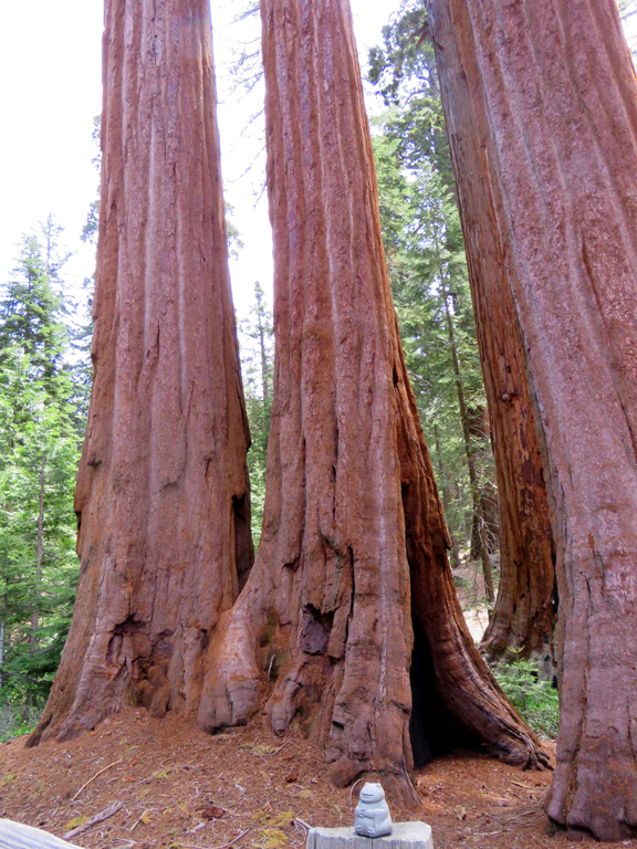
click here or on the image above for more Sequoia-King's Canyon and Shaver Lake photos |
California
We had originally planned on camping in Sequoia National Park, Sentinel Campground, but there were a couple of factors that
made that impossible. One was a controlled burn (and smoke) in the Cedar Grove area, where the campground is. Another is that the facilities
in the campground (showers, laundry, restrooms) were all closed, temporarily. The situation seems to be that the National Park
Service contracts with outside vendors for running the lodges and park facilities, including the campgrounds. In more than a few cases,
there have been abuses of these contracts: for example, Xanterra trademarked all the iconic names, like "Bright Angel Lodge"
and "Grand Canyon Village," probably as a way of 1) hedging their contract or 2) trying to make a killing selling
the name back to the NPS (which is us, actually). In the Grand Canyon case, the Park Service sued and won, and the relationship with Xanterra is done. Aramark is
taking over, and the changeover has not been smooth, hence the closures. At Yosemite, it's worse. A different management company
trademarked "Yosemite Lodge," "Ahwahnee Lodge," "Wawona Hotel,"Curry Village," and even
"Yosemite National Park." The lawsuits are ongoing and $50 million are at stake.
~~~~~~~~ |
|
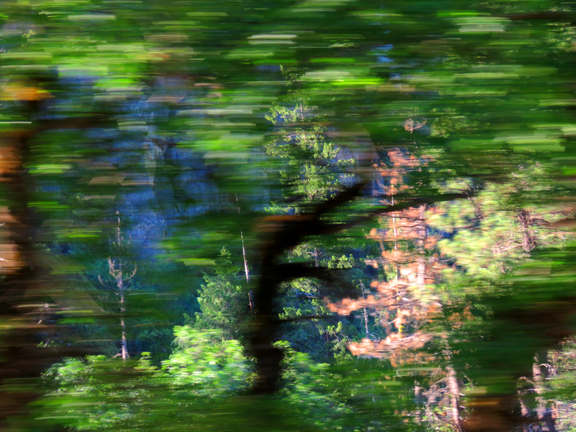
click here or on the image above for more yosemite national park photos |
california
"Get there early" is the advice, and well taken. All the parking lots fill by mid-morning. All the trailhead parking lots
are full. The many shuttle buses are sardine cans squeezed full of people but have their own road lanes. And people who decide it's
a good idea to drive experience 2-3 hour delays because of the congestion. We arrived at Yosemite Village at 7:30 a.m. and found good parking,
yet even a few minutes later all the spots were filling.
~~~~~~~~ |
|
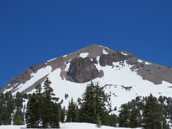
click here or on the image above for more lassen volcanic photos |
california
Originally, we had reservations at the Manzanita Campground at Lassen Volcanic National PArk. However, some late-season
heavy snowfall kept the road through the park closed until just before we arrived, and the center section was still not open to
motor vehicles. Just couldn't see setting up a tent on several feet of snowpack...
~~~~~~~~ |
|
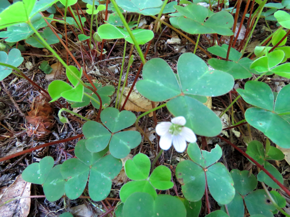
click here or on the image above for more redwood national park photos |
california
This was our third visit to Redwood National Park.
~~~~~~~~ |
|
Text and images copyright 2019 Thomas D'Alessio & Jocelyn Boor